Development Land with Highway Frontage – Westover, MD
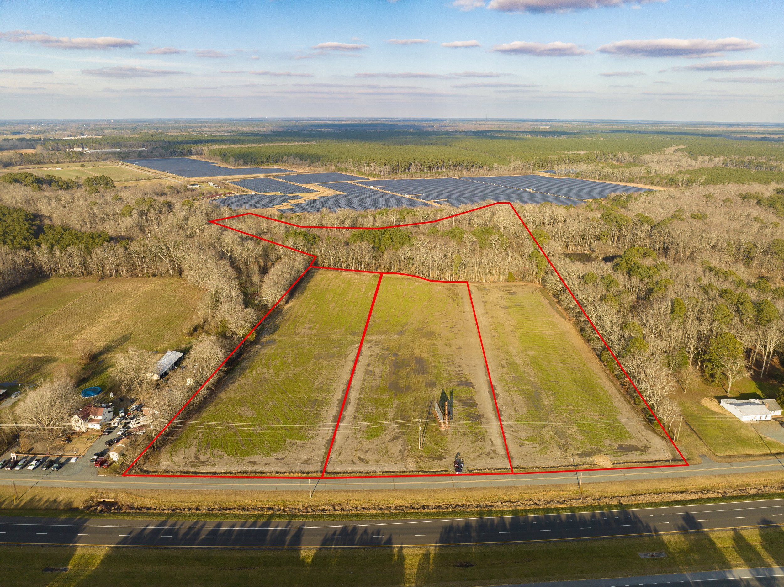
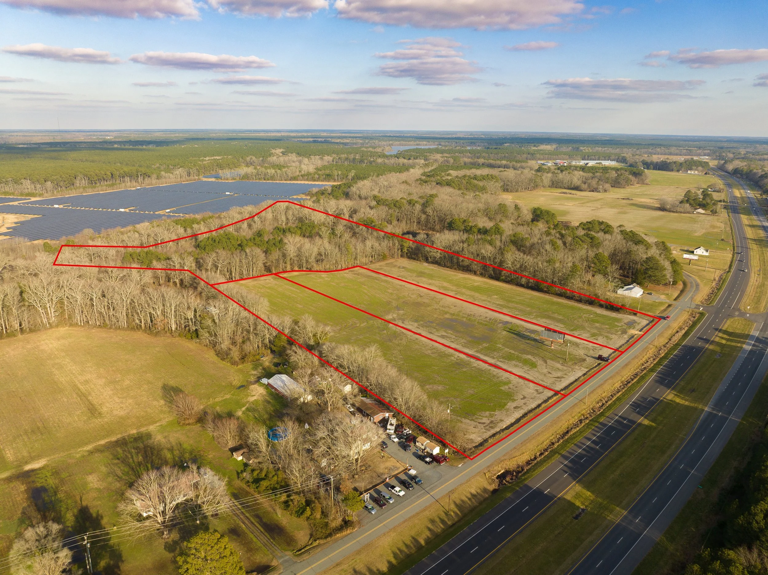
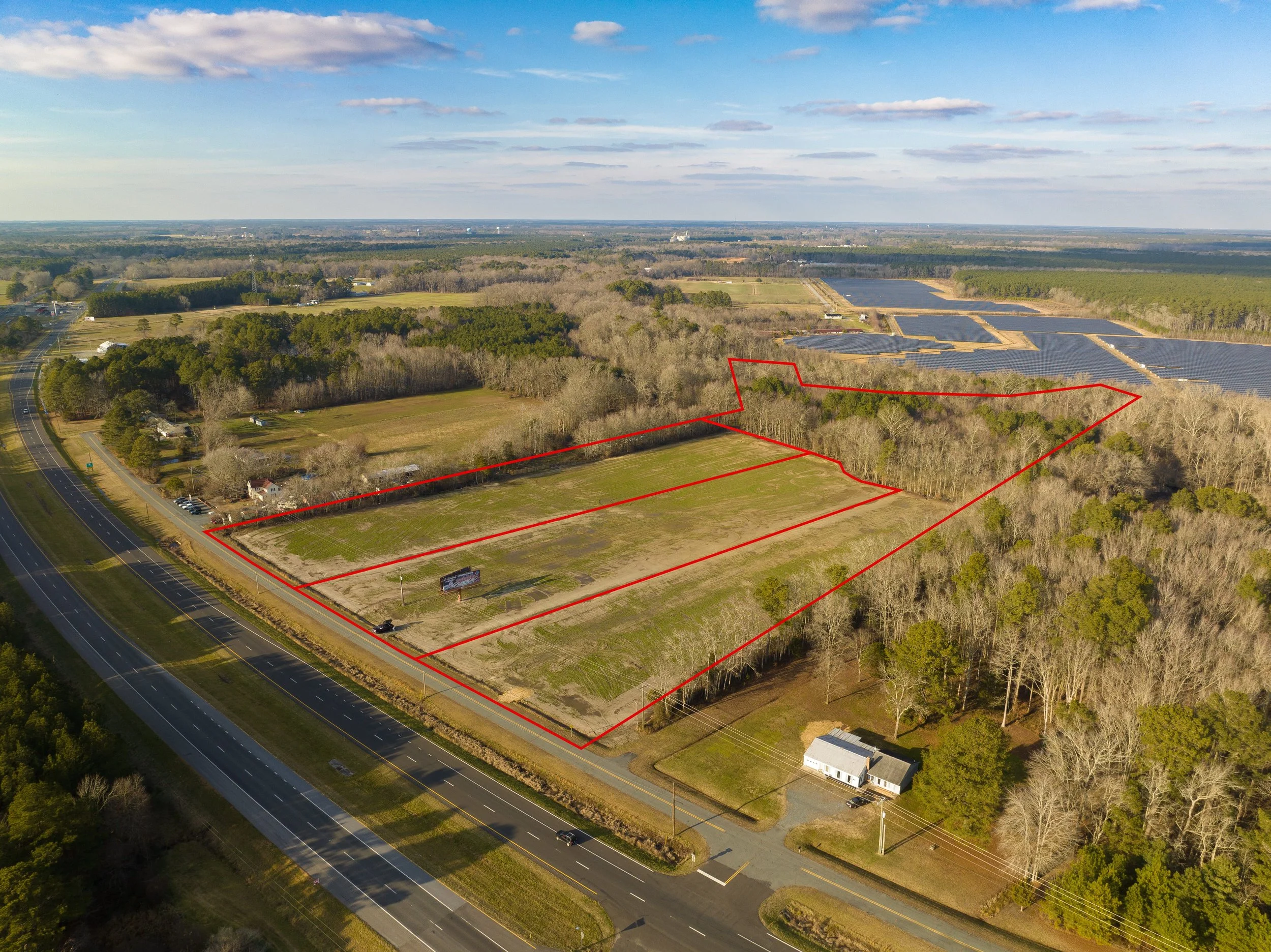
This drone photography project showcases a large vacant land listing in Westover, Maryland. High-resolution aerial imagery and approximate property boundary overlays clearly define the parcel while highlighting its highway frontage, surrounding landscape, and proximity to nearby commercial development. These aerial perspectives provide buyers, developers, and investors with a clear understanding of the property's size, layout, and location.